Existential questions are part of being human. Who hasn’t asked themselves, ‘Why do I care?’ or ‘What is the purpose of all of this?’ These philosophical questions have challenged our species since the beginning of time. When I think about questions like this, I like to head to the woods. With the news cycle growing ever more chaotic, it’s easy to feel overwhelmed. So, I went to the woods to ponder why I gave a dam.
The town of Easton is what it is today because people gave a dam. Lots of dams.
While the town is known for its reservoirs and, less so, its modern dams, it’s the older ones that are arguably the most fascinating. One of these old dams, off South Park Avenue and Buck Hill Road, still stands on each side of the Mill River. It no longer creates a pond, but it does offer excellent views, a history lesson, and a popular hideout for fly fishers.
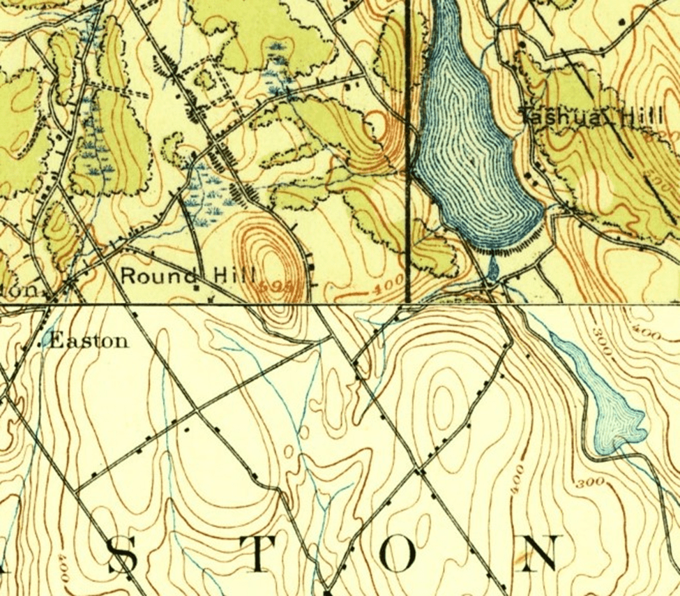
Easily visible from Buck Hill Road and when heading north on South Park Avenue, the rock faced dam was originally constructed in 1886. Today, the cool water of the Mill River runs clear as glass between its 139-year-old walls. Parking at the lot across South Park Ave offers two ways to access the dam.
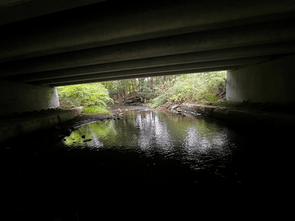
For an adventure, you can head into Warner Anglers Preserve and follow the river north. The trip will take you under the nearby bridge. If you’ve never been, I promise there are no trolls or creatures to worry about. Based on the debris, however, you may spot teenagers with a case of beer. Aside from carrying cars, the underside serves as a local hideout for rebellious youth. We were all young adults once, so it’s really no bother. (Though I do wish they’d take the garbage with them.)
If you’re not so adventurous, then cross South Park Avenue and head into the woods. There are no marked trails here, except for those worn into the soil by anglers, hikers, drinkers, or a combination of the three. The terrain is forgiving, and some of the sights will remind you just how close you are to the ‘busy’ intersection of Buck Hill Road and South Park Avenue. The river offers all the necessary guidance to reach the dam.
Approaching from the south makes Easton Dam Number 1 appear more grandiose than it is. Sort of like the man responsible for its construction, PT Barnum. The rocks are jagged and the vines hanging down are almost inviting enough to convince the most daring visitor to try to scale the wall. Barnum founded the Citizens Water Company (CWC) and bought this land to compete with the Bridgeport Hydraulic Company (BHC). The city of Bridgeport, an important industrial hub at the time, was rapidly expanding and needed to secure more water. But Mr. Barnum should have stuck to the circus. Two years after the dam’s completion, a court ruled that the company could not install the pipes necessary to get water where it was needed. The circus left town, and the CWC sold its assets to the BHC.
Easton Dam Number 1 was functionally replaced by Easton Dam Number 2 in 1926. As you pass the dam and continue upstream, the landscape makes it easy to tell where the old pond used to be. Aside from the hills, the trees on this side of the dam are noticeably smaller in diameter compared to the older growth on the banks of the river downstream. The top of the dam offers a fantastic view of the river below and the forest surroundings.
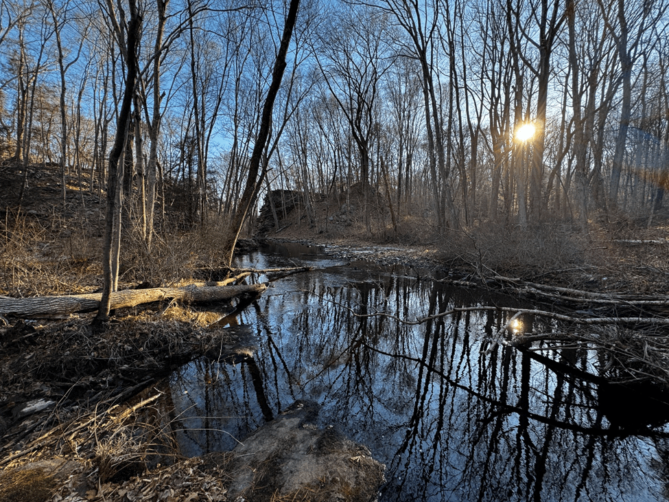
Careful footing is needed to reach the top, but the trek is not dangerous. There, you’re rewarded with a spectacular view and a bit of engineering history. The pump shaft is still visible, as are the rusted iron remnants of industry along the river. A popular spot for anglers and wildlife, the area offers plenty to see.
So, this past weekend, my daughters, wearing their cute winter boots, and I, explored the dam. It was a beautiful, cold afternoon. The peace of the forest was only slightly disturbed by nature’s subtle reminders of its inherent violence. A lone white feather, then another, and then a pile that made it clear that a creature had enjoyed a winged meal recently. Nearby, a flock of American Black Ducks took off from the surface of the water, reminding us we were not alone.
After examining the crime scene, we moved further towards the water’s edge to admire the Mill River in its golden-hour glory.
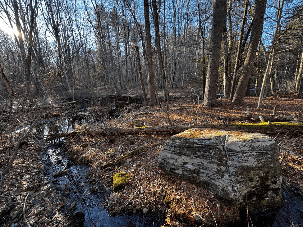
The girls didn’t know this, but there was another lesson in these woods. One of persistence and patience. It comes in the form of a boulder left by retreating glaciers at the end of the last ice age. Yes, I took my daughters into the woods to see this rock. Because, in a tangible way, it is alive. Sort of.
It is, at least, a work in progress. Looking like a stick of butter with a knife groove, the boulder sports a remarkably straight fracture from top to bottom. A testament to the strongest force in the world, water. Exposed to the freeze and thaw cycle for thousands of years, water has fractured it almost into two distinct pieces.
There’s more than one lesson here for the girls. For today though, I simply point out the fracture, and we move forward. After taking the adventurous path to the dam, we opt for the straightforward way out. Along the path, there’s a different, and far quicker example of a fracture. The bird wasn’t the only animal recently on the menu in these woods!
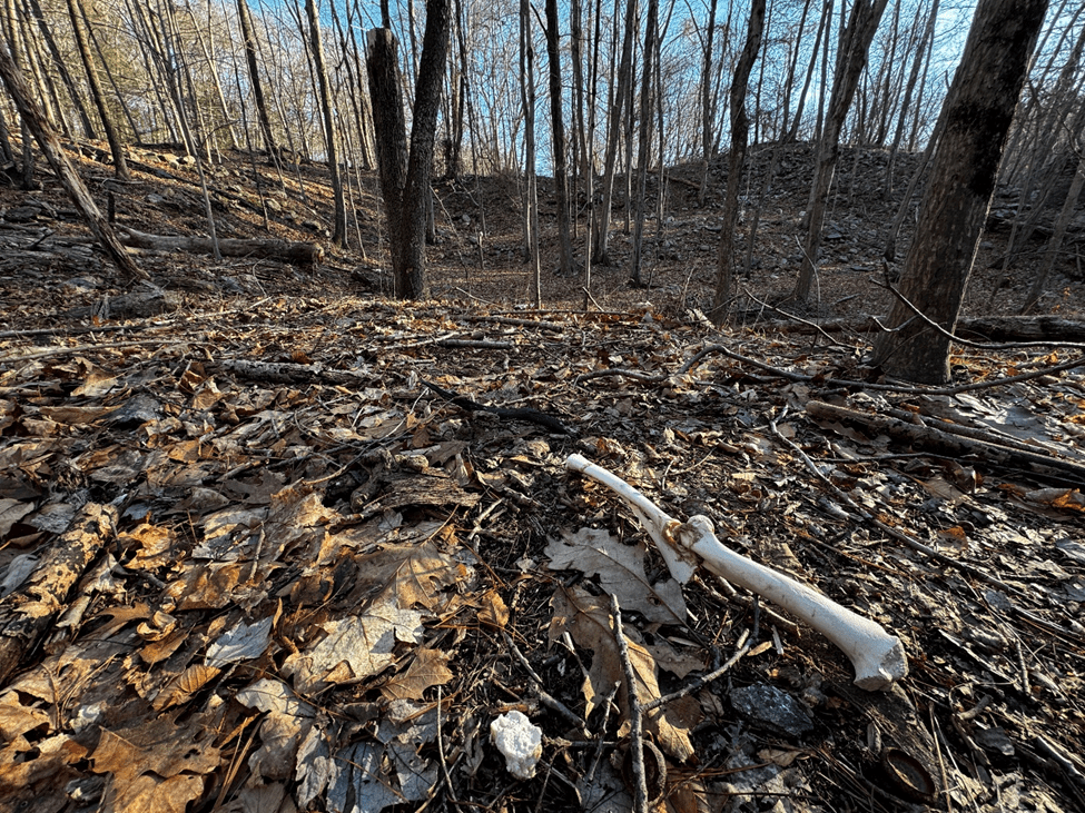
We examine the leg bone of a deer. To my surprise, the girls want to see what it feels like. In a word, “weird!” The youngest spots another piece of bone nearby. We exit the forest along Buck Hill Road, where every stick has become another bone in their imagination.
The water shaped this land, then man did, but the force of nature reigns supreme. I took my daughters to see this rock, cleaved by water.
Because I give a dam.
Jonathan J Webster
February 1, 2025
