The rasping calls above me signal that the reason this trail was closed until recently is still active in the area. I’ve heard them before in Easton, but this time they are much closer. I stop and wipe some sweat from my brow and scan the cliff face and trees above me. I can’t spot the bird making the calls, but the Merlin app on my phone confirms its identity, just as it has in the past at home. The fastest animal on the planet, reaching speeds over 200 miles an hour in its hunting stoop, the peregrine falcon calls the cliffs of Champlain Mountain home. The Precipice Loop Trail in Acadia National Park is closed through much of the spring and summer so hikers don’t disturb these sensitive nesting sites.
We didn’t time our vacation around the trail schedule. It would have been folly to try to guess when the birds would leave their nests. The National Park Service closure notice said the timing was usually mid-August. As a Park Ranger (awesomely named Kestrel) told me a day before, mid-August could mean anywhere from the 15th to the 31st. But this year I was lucky, I was on vacation in Acadia for opening day, August 15, 2026.
We hiked the park’s well-known Beehive the day before. My wife and son went up the famous trail with its iron rungs and awesome views while my daughters and I hiked up the easier back route. We came back down the mountain as a family, and then I set off to go up the mountain on the harder route. After climbing to the top of Beehive twice, my legs and feet were a little sore, but not sore enough for me to miss my chance to hike the more difficult Precipice Loop.
The following day, after getting dropped off at the trailhead by my family, I started the hiking activity on my watch and climbed the granite staircase at the beginning of the trail. It was the afternoon, and there were several cars in the parking lot. Traffic on the trail was thin though, and provided a dual enticement of serenity and the comfort of knowing that if I fell or otherwise injured myself there would eventually be some help coming along.
As for the hike, it easily registered as one of the hardest I’ve ever done. Early on, the trail gains elevation at a staggering pace, rising 1,000 feet in just under a mile. The first test of my will to proceed came early on, when I had to use all my strength to navigate an iron rung path up a boulder with a forward pitch. The two hikers in front of me decided to take their first break on the hike, joking that it now wouldn’t be their fault if we were to get lost. I looked at the rungs, wondering why there wasn’t at least one more. It seems like the stewards wanted to provide an early test. If you can’t get past this first obstacle, turning around here and heading back down the trail is not as perilous as doing so from anywhere up ahead. I pulled up my pant legs and swung my legs up the rock, unsure of myself but with enough grip to propel myself onto the rock. My journey had officially begun. After some scrambling over boulders marked clearly with blue blazes, the trail turns as it switches back and forth up the face of the mountain. Some of these areas have iron banisters for safety but many more of them do not. The trail is only about two feet wide for most of the way up, and my left hand spent a lot of time grasping the granite for comfort.
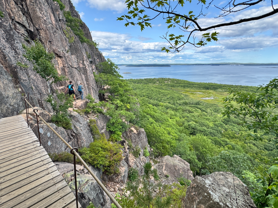
As I continued, the hike turned more into a climb than a walk in the park. Climbing up granite with the occasional iron rung support, I was glad I had hit the gym to train my legs for the task rather than attempting the hike “off the couch.”
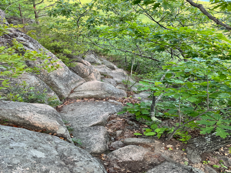
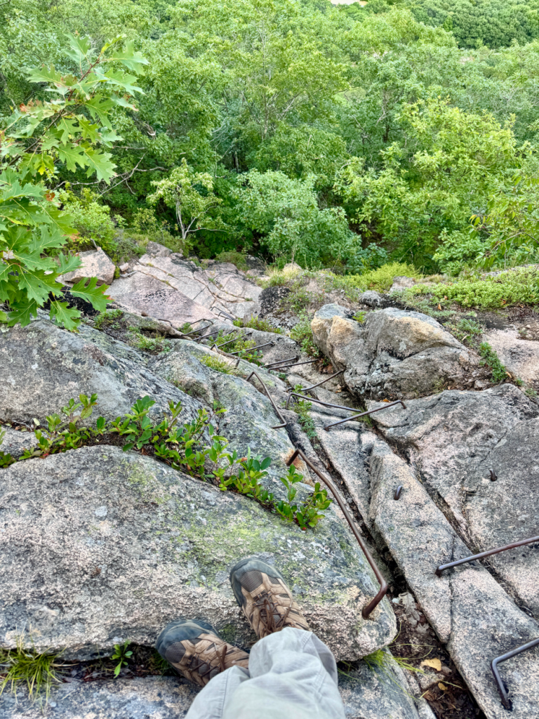
As the trail gets closer to the summit, the iron ladders become more frequent. A portion of the trip was one section of ladder after another with little break in between. More than a few times, my mind noticed the rusted color of the rungs and drifted into uncomfortable thoughts over just how long they’d been on the mountain and how much longer they’d stay sturdy. But with nowhere to go but up, I continued.
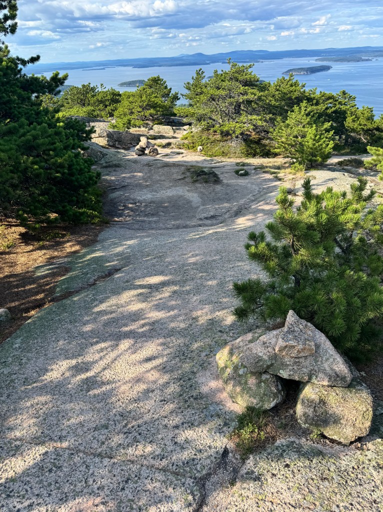
The trail forces you to go relatively slow, which is a good thing because the views on the way up are spectacular. Frenchman Bay shimmered in the afternoon light. On the far side, the Schoodic Peninsula stretches out into the Gulf of Maine. In between, islands with names like Turtle, Ironbound, and the Porcupines rise from the waterway.
Upon reaching the summit, there’s a final scramble up some sheer granite to reach the sign denoting the top of the 1,058 foot mountain. Feeling accomplished, I stopped to rest for a few minutes before heading down the Champlain North Ridge Trail, again marked with blue blazes but also with historic cairns. In some spots, it was easier to find the decades-old markers than the newer blue paint.
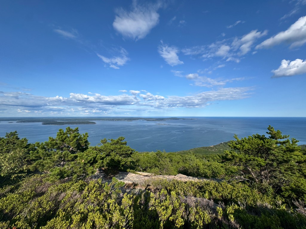
The ridge trail eventually meets up with the Orange and Black Path, which descends the mountain further and includes granite staircases. The descent, while not as punishing as the ascent, remains challenging with several steep sections. As for the views, they remain excellent, especially Beaver Dam Pond and the Porcupine islands. Given that it was the afternoon and I had already been away from my family for a couple of hours, I chose to take the easiest route back to the trailhead, walking up Park Loop Road and back to where I started to officially end my hike.
The falcons flying from their nests on the way up were a stunning sight. I saw two soaring down the mountain, but I wasn’t quick enough to snap a photo. The birds, listed as threatened by the state of Connecticut, were considered extirpated in the eastern United States in the mid-sixties. This was largely the result of pesticides such as DDT, which thinned eggshells and collapsed breeding success. DDT was banned in 1972, making reintroduction possible. The bird, which had been added to the federal endangered species list in 1970, recovered as biologists released captive-bred birds into the wild. While Connecticut didn’t participate in the effort, we did reap the benefits from neighboring states. The peregrine was removed from the federal endangered species list in 1999.
Falcons like to nest on rock cliffs, highway bridges, and even tall buildings. Locally, they prefer to stay along the Long Island Sound rather than inland, but they have been spotted in Easton so it’s worth keeping an eye out for them. I’ll be sure to do that as we enter peak hiking season. See you on the trails.
A note:
Overall, I really enjoyed the trek and am thankful that I got the opportunity to do it. If you ever plan to visit Bar Harbor and Acadia National Park, I highly recommend planning to hike this trail. Make sure to bring a good set of hiking shoes and leave the trekking poles behind as they’ll only get in the way. We had other plans in the morning, so hiking in the afternoon meant going up the mountain mostly shaded from the sun. Hiking this trail in the morning means doing so with little cover from the sun, so be sure to bring sunscreen and extra water. The trail is dangerous, so if you’re not used to hiking or are afraid of heights, you probably should stick to the park’s tamer trails. We really enjoyed the Ocean Path for its stunning views from the cliffs along the water.

